Fieldwork
Sherdukpen
Introduction - The Project among the Sherdukpens - How to write Sherdukpen ? - Sherdukpen society, a brief description - Sherdukpens and their neighbours - The road to the North, Tawang, Tibet and Bhutan - The road to the south, to Kachari country and Assam - Rupa, a fascinating history – Language.
(updated 28th June 2012)
Rupa, a fascinating history

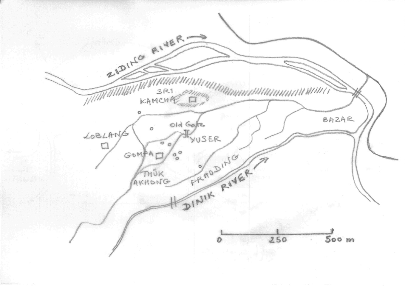
The town of Rupa is situated on the confluence of the Ziding and the Dinik rivers. It is connected to the main road, the bigger Tawang-Bomdila-Charduar-Balukpong-Tezpur road. You leave Rupa by a bridge just after the Bazaar quarter, you turn right and after travelling for two kilometres and crossing another bridge, you arrive at the main road.

Sri Kamcha, Loblang and the Gompa are important religious or ritual places
Yuser, ThükAkhong, Praoding and Bazaar are quarters in Rupa
Small circles (o) indicate Clan Houses
Nowadays, the first thing people see when they leave the Bomdila road and reach land looking down over Rupa is the pervasive presence of the Indian army. Army camps spread all over the flat valleys, for instance at the entrance of Rupa before and after the bridge, or in the Ziding valley, although part of the land here has been returned to the Sherdukpens for agricultural purposes. But no military personnel has settled in Rupa itself.
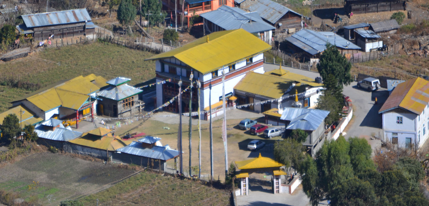
The Bazar quarter is a rather recent development, and one or two generations ago the actual entrance to the Village was the Old Gate, in the Yuser quarter. The older village was mostly to be found in the Thük Akhong part – a name that means 'Old Village' in Sherdukpen. The Gompa was also a dzong, a fortress, until it was recently rebuilt on practically the same plot of land. The most important ritual places, Loblang and Sri Kamcha, were on the outer fringe of the village proper, Sri Kamcha on its hillock dominating the Ziding Valley farther down, and Loblang, on the contrary, like a gate to the mountains and to the mountain path which climbs steeply once you pass through it. As to the Praoding quarter along the Dinik river, many people remember the time (before the 1980s) when there were no houses there, and it was just land. And people will tell you how the land just south-west of Loblang (now connected by a modern road to the administrative quarters, and to Thungri, with many new houses) was jungle, with high bamboos, and dangerous animals that ventured to the village along that side.
Until the 1960s, the place for the dead was a low mountain slope, along the Ziding (on the western limit of the sketch). There were caves where dead people were buried, or rather 'placed'. The members of Upper clans or Thong were placed inside in a sitting position, while Chao people lay at their feet on the floor.

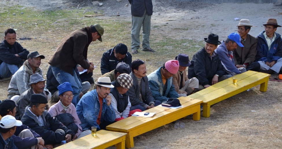
Most meetings of Tukpen Village Council take place in the Gompa courtyard, situated right in the middle of the old village, and still easily accessible. The Council even has its office in the Gompa precinct, though neither Buddhism itself nor the Buddhist priest in-charge of the temple interferes in any way in these meetings, though Sherdukpen priests, the Khikzizi, do attend and formally open the sessions.
