Fieldwork
Ze-liang-rong
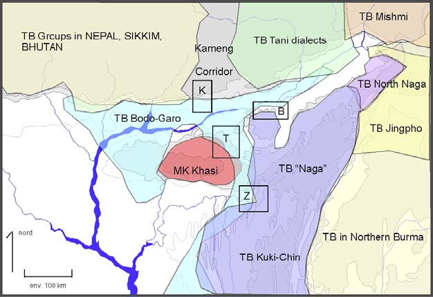
Area Z on the Linguistic Sketch Map below
In the center of the second map we see the converging borders of three Indian states (red line): Assam on the left, Nagaland in the upper right, Manipur in the lower right. On the extreme right is Burma.
The width of the map is roughly 300km. The pale grey lines delimit language areas, with a very small group, the Zemi, Liangmai and Rongmei, forming the Zeliangrong, straddling the three states. Their composite name is the mark of a desire to unite. Their languages are close but distinct, more distinct than dialects.
The Zeliangrong are considered to be “Naga,” by locals and scholars alike. In several features though, they are more like the “Kuki,” the “opposite” group, the enemy brothers. Their languages can be considered transitional between the central Naga languages and the Kuki languages to the South; but they also share features with Bodo-Garo languages like the Boro of the Brahmaputra valley, or the Kokborok of Tripura.
This situation is provides an excellent case for study of the interaction of political, linguistic and cultural factors in group identity.